Geography of Bangladesh

Geography of Bangladesh : Quick look
Location: Southern Asia, bordering the Bay of Bengal, between Burma and India.
Geographic coordinates: 24 00 N, 90 00 E.
Map references: Asia
Area:
total: 144,000 sq km.
land: 133,910 sq km.
water: 10,090 sq km.
Area-comparative: slightly smaller than Iowa.
Land boundaries:
total: 4,246 km
border countries: Burma 193 km, India 4,053 km
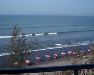
Coastline: 580 km.
Maritime claims:
contiguous zone: 18 nm.
continental shelf: up to the outer limits of the continental margin.
exclusive economic zone: 200 nm.
territorial sea: 12 nm.
Climate: tropical; mild winter (October to March); hot, humid summer (March to June); humid, warm rainy monsoon (June to October)
Terrain: mostly flat alluvial plain; hilly in southeast.
Elevation extremes:
lowest point: Indian Ocean 0 m.
highest point: Keokradong 1,230 m.
Natural resources: natural gas, arable land, timber.
Land use:
arable land: 61%
permanent crops: 3%
other: 36% (1998 est.)
Irrigated land: 38,440 sq km (1998 est.)
Natural hazards: droughts, cyclones; much of the country routinely flooded during the summer monsoon season.
Environment-current issues: many people are landless and forced to live on and cultivate flood-prone land; limited access to potable water; water-borne diseases prevalent; water pollution especially of fishing areas results from the use of commercial pesticides; intermittent water shortages because of falling water tables in the northern and central parts of the country; soil degradation; deforestation; severe overpopulation.
Environment-international agreements:
party to: Biodiversity, Climate Change, Climate Change-Kyoto Protocol, Desertification, Endangered Species, Environmental Modification, Hazardous Wastes, Law of the Sea, Nuclear Test Ban, Ozone Layer Protection, Wetlands signed, but not ratified: none of the selected agreements
Transnational Issues
Disputes-international: Only a small portion of the boundary with India remains undelimited; discussions to demarcate the boundary, exchange 162 miniscule enclaves, and allocate divided villages remain stalled; skirmishes, illegal border trafficking, and violence along the border continue; Bangladesh has protested India's attempts to fence off high traffic sections of the porous boundary; Burmese attempts to construct a dam on the border stream in 2001 prompted an armed response halting construction; Burmese Muslim refugees migrate into Bangladesh straining meager resources.
Curacy of.......
Location: Southern Asia, bordering the Bay of Bengal, between Burma and India.
Geographic coordinates: 24 00 N, 90 00 E.
Map references: Asia
Area:
total: 144,000 sq km.
land: 133,910 sq km.
water: 10,090 sq km.
Area-comparative: slightly smaller than Iowa.
Land boundaries:
total: 4,246 km
border countries: Burma 193 km, India 4,053 km
Coastline: 580 km.
Maritime claims:
contiguous zone: 18 nm.
continental shelf: up to the outer limits of the continental margin.
exclusive economic zone: 200 nm.
territorial sea: 12 nm.
Climate: tropical; mild winter (October to March); hot, humid summer (March to June); humid, warm rainy monsoon (June to October)
Terrain: mostly flat alluvial plain; hilly in southeast.
Elevation extremes:
lowest point: Indian Ocean 0 m.
highest point: Keokradong 1,230 m.
Natural resources: natural gas, arable land, timber.
Land use:
arable land: 61%
permanent crops: 3%
other: 36% (1998 est.)
Irrigated land: 38,440 sq km (1998 est.)
Natural hazards: droughts, cyclones; much of the country routinely flooded during the summer monsoon season.
Environment-current issues: many people are landless and forced to live on and cultivate flood-prone land; limited access to potable water; water-borne diseases prevalent; water pollution especially of fishing areas results from the use of commercial pesticides; intermittent water shortages because of falling water tables in the northern and central parts of the country; soil degradation; deforestation; severe overpopulation.
Environment-international agreements:
party to: Biodiversity, Climate Change, Climate Change-Kyoto Protocol, Desertification, Endangered Species, Environmental Modification, Hazardous Wastes, Law of the Sea, Nuclear Test Ban, Ozone Layer Protection, Wetlands signed, but not ratified: none of the selected agreements
Transnational Issues
Disputes-international: Only a small portion of the boundary with India remains undelimited; discussions to demarcate the boundary, exchange 162 miniscule enclaves, and allocate divided villages remain stalled; skirmishes, illegal border trafficking, and violence along the border continue; Bangladesh has protested India's attempts to fence off high traffic sections of the porous boundary; Burmese attempts to construct a dam on the border stream in 2001 prompted an armed response halting construction; Burmese Muslim refugees migrate into Bangladesh straining meager resources.
Curacy of.......

মন্তব্যসমূহ
একটি মন্তব্য পোস্ট করুন